FO AND F2 RATED (MAF/NWS) TORNADO, SOUTHEASTERN BORDEN COUNTY, TEXAS, JUNE 2005
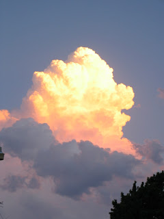
The first Image was taken in eastern Dawson County on SH 180, near SH 87 intersection, looking east/south/east toward Borden County at a  developing "Tail-End Charlie" Storm Tower apart of a larger multi-cell complex but separated. My youngest daughter and I chose this cell to chase because of its position although stronger mature cells from a distant complex, north, existed at the time.
  Approximately 8 miles east of the townsite of Gail, in Borden County, on SH 180, looking to the south, we took the next digital image of a conical descending Wall Cloud as marble size hail began to fall from the RFD. We turned down the caliche road as indicated in photo and drove several miles south and took the third image of the first indication of a small tubular vortex beginning to descend with hail still originating aloft over the viewed updraft circulation but transported counterclockwise over us and on the northwestern side of the Wall Cloud
 .
.
The fourth image was taken only moments later as the tornado touched down, as noted from debris cloud on surface. The fifth image became obscure at the base of the tornado, although it may have retreated slightly, due to hail and rain cascading from the RFD as it neared the vortex.  The sixth image is taken as driving back toward Gail, on SH 180, approximately 3-4 miles east of Gail looking south at intensifying tornado.
  This small Supercell was almost stationary with little movement noted and later seemed to have a retrograde movement toward the southwest. The final image is from MAF NWS WSR-88D radar (composite reflectivity), courtesy of the NWS at MAF "Dust Devil Dispatch" newsletter
 . As a side note the author called his oldest daughter, meteorologist at a Midland/Odessa news station, and provided "ground truth" conformation of the visual sighting with VIPIR radar display(s) which was detecting low-level circulation within the BWER. Below the radar image the author has attached two digital photographs of the tornado as it apparently intensified, based on visual larger cone-shaped size, as captured on FM 669 near the Borden/Howard Countly line looking east.
  An F2
An F2  rated tornado survey by MAF NWS, as shown on last attachment, and determined to have occured later in time than the author was present is suggestive of the southwest retrograde direction of this small Mesocyclone. The last graphic is also from the NWS at MAF "Dust Devil Dispatch" newsletter.


